
Satellites, AI, sensors, and geospatial data on a single foundation, supporting situational awareness and decision-making at sea, in the air, and on land.
Supply to Japan is subject to United States export control laws. Where authorization is required, it has not been granted at this time. Any application is made by the manufacturer, and approval is decided by the United States government. Nothing on this page is an offer to sell.
The Space-Eyes products are not standalone tools. They connect satellites, sensors, and AI on a shared foundation: an architecture built to hold a picture that crosses domains.
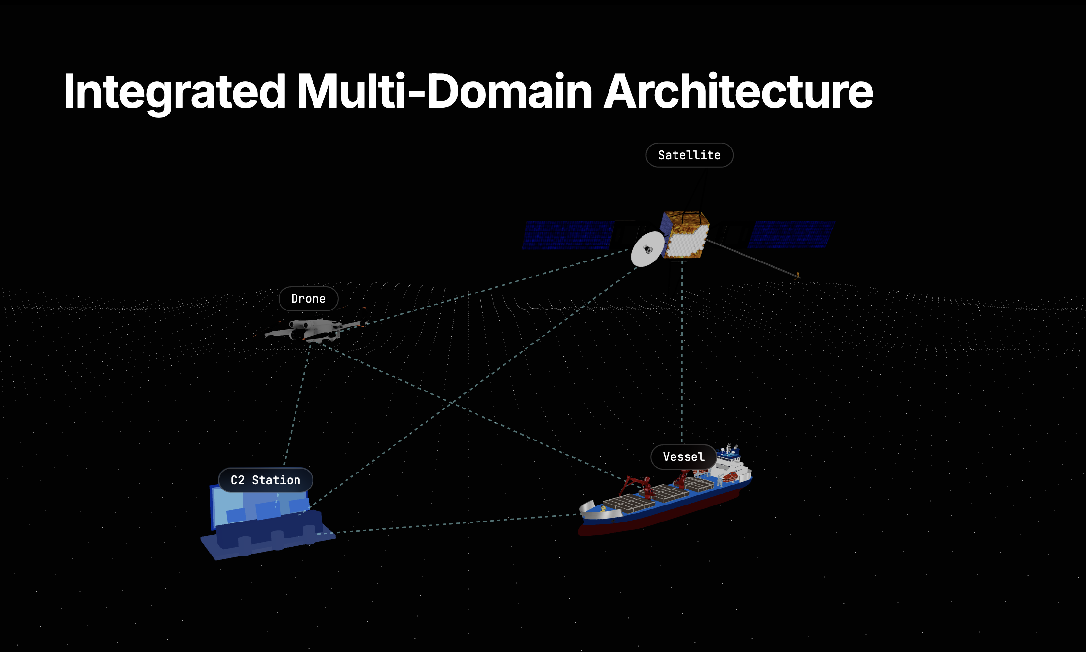

© Space-Eyes, Inc.
According to the manufacturer, MORPHEUS™ is a counter-unmanned aerial system (C-UAS) that combines RF signal processing, artificial intelligence and quantum-resistant security. It is designed to detect, identify and classify unmanned aircraft entering protected airspace in real time and to give the command post a single air picture.
Electromagnetic signatures are analyzed across multiple frequency bands, and the system is designed to determine the type of aircraft, its manufacturer, its protocol, and its threat profile, to help operators see unmanned systems inside protected airspace.
AI is designed to separate the authorized from the benign and the hostile. Data correlation and pattern validation are designed to reduce false positives and shorten the path from detection to decision.
The system is designed to learn what normal looks like in its operating environment, building up flight routes, loitering behavior, and patterns tied to time of day or to particular events, to help direct attention before a threat materializes.
According to the manufacturer, the system includes mitigation functions for use by authorized operators. In Japan, operating such functions is restricted by law (see the notice below). RF signals are analyzed continuously, and the analysis is designed to help reveal the likely source behind spoofing and masking, and the origin and behavior of an unmanned aircraft that would otherwise stay hidden. The system is designed to operate autonomously in crowded and contested electromagnetic environments.
Notice for Japan: transmitting radio signals in Japan, including for jamming, spoofing or taking control of a drone, requires a license or other authorization under the Radio Act. Measures that interfere with a drone's flight are reserved to bodies authorized by Japanese law. The functions described are the manufacturer's descriptions of the product in general. They do not mean that every function can be supplied to or operated by every customer in Japan.
To discuss your requirements, please contact Pivot Company, Limited, the exclusive representative for Japan.
At the core of the Space-Eyes intelligence architecture is the CATE™ Engine, an adaptive AI that learns from signals, images, and anomalies. It identifies risk, prioritizes alerts, and helps surface what would otherwise be missed.
An AI-driven maritime geospatial intelligence platform. Vessel traffic, fleet operations,
and port congestion, in real time.
Custom rules, triggers, and geofences can be defined, and satellite imagery tasked
automatically, which helps identify vessels sailing with AIS switched off.
A sensor fusion engine brings satellite imagery, AIS broadcasts, and RF bearings into a
single spatio-temporal frame, which is designed to raise detection confidence.
Exclusive Economic Zones can be monitored, with violations and
suspicious activity tracked and reported automatically, and reports generated on vessel
behavior and port congestion.
An AI platform built on satellite imagery, weather data, and 3D visualization. It detects
heat signatures globally from satellite data, subject to coverage, and monitors reported fires as they develop.
Immediate alerts, fire-spread simulation, and automated reporting support emergency
response. Spread prediction models account for terrain, weather, and vegetation.
Areas of interest can be defined, with email notification when a fire inside one is
reported or updated. Available on desktop, tablet, and mobile.

A geospatial intelligence and counter-drone technology company headquartered in Miami, Florida.
For current company information and press releases, see the official Space-Eyes, Inc. newsroom.
Pivot Company, Limited is the exclusive representative in Japan for Space-Eyes. We are the first point of contact in Japan: we introduce the products, handle communication in Japanese, and coordinate between you, the manufacturer and, where one is involved, your Japanese contractor. Installation, maintenance and technical support are provided by the manufacturer. Pivot is not the seller or importer of the products and holds no stock.
Supply to Japan is subject to United States export control laws. Where authorization is required, it has not been granted at this time. Any application is made by the manufacturer, and approval is decided by the United States government. Nothing on this page is an offer to sell.


Pivot is the exclusive representative and your first point of contact in Japan. Supply to Japan is subject to United States export control laws. Where authorization is required, it has not been granted at this time. Any application is made by the manufacturer, and approval is decided by the United States government. Once we understand your requirements, we bring in the manufacturer, which proposes the configuration.
Yes. Pivot communicates with you in Japanese and relays technical questions to the manufacturer. Pivot does not itself install, maintain or provide technical support for the systems.
After you make contact, we discuss the intended use and operating environment, then arrange technical discussion with the manufacturer, which proposes a configuration.
According to Space-Eyes, its systems are intended for defense, security and commercial users. There are no deployments in Japan at this time.
According to the manufacturer, a modular architecture and APIs are designed to support integration with existing infrastructure. Whether integration is possible in a given case is assessed by the manufacturer.
This page gives a general description only. Detailed technical information is provided by the manufacturer, subject to United States export control requirements.
A counter-UAS (C-UAS) system detects, identifies, and tracks drones entering protected airspace, and mitigates them where authorized. Approaches include radar, RF signal analysis, and optical sensors; MORPHEUS™ is built on RF signal processing with AI-based identification.
According to the manufacturer, the emphasis is on identification and discrimination as well as detection. It is designed to analyze electromagnetic signatures across multiple frequency bands to determine airframe type and communication protocol, and to separate authorized aircraft from threats in order to reduce false alarms. Mitigation functions are for use only by bodies authorized under applicable law.
The systems are designed for sites such as bases, ports, airport perimeters, critical infrastructure such as power plants and substations, and large event venues.
Maritime domain awareness (MDA) means maintaining a continuous picture of what is happening at sea. SeaWatch™ fuses AIS with satellite imagery to track vessel movement, and helps identify vessels operating with AIS switched off.
It depends on the use case and operating environment. After you contact us, we will review your requirements with the manufacturer, which sets out the expected timeline.